Geochemistry of the medieval manor
We trace elements associated with settlement, waste, construction materials and economic activity.
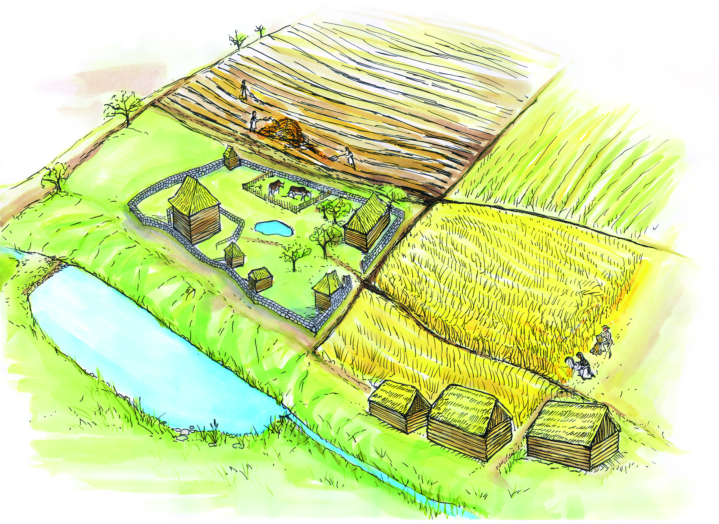
A deserted medieval manor, village hinterland and relict fields as an archive of long-term farming, manuring and landscape transformation after abandonment.
Třebokov allows us to trace how medieval farming remains recorded in soil after centuries of reforestation.
We trace elements associated with settlement, waste, construction materials and economic activity.
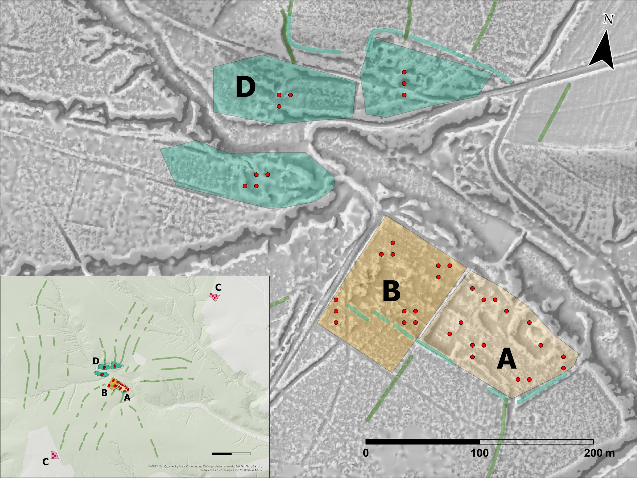
LiDAR and soil data show former fields, plot boundaries and land-use traces hidden below woodland.
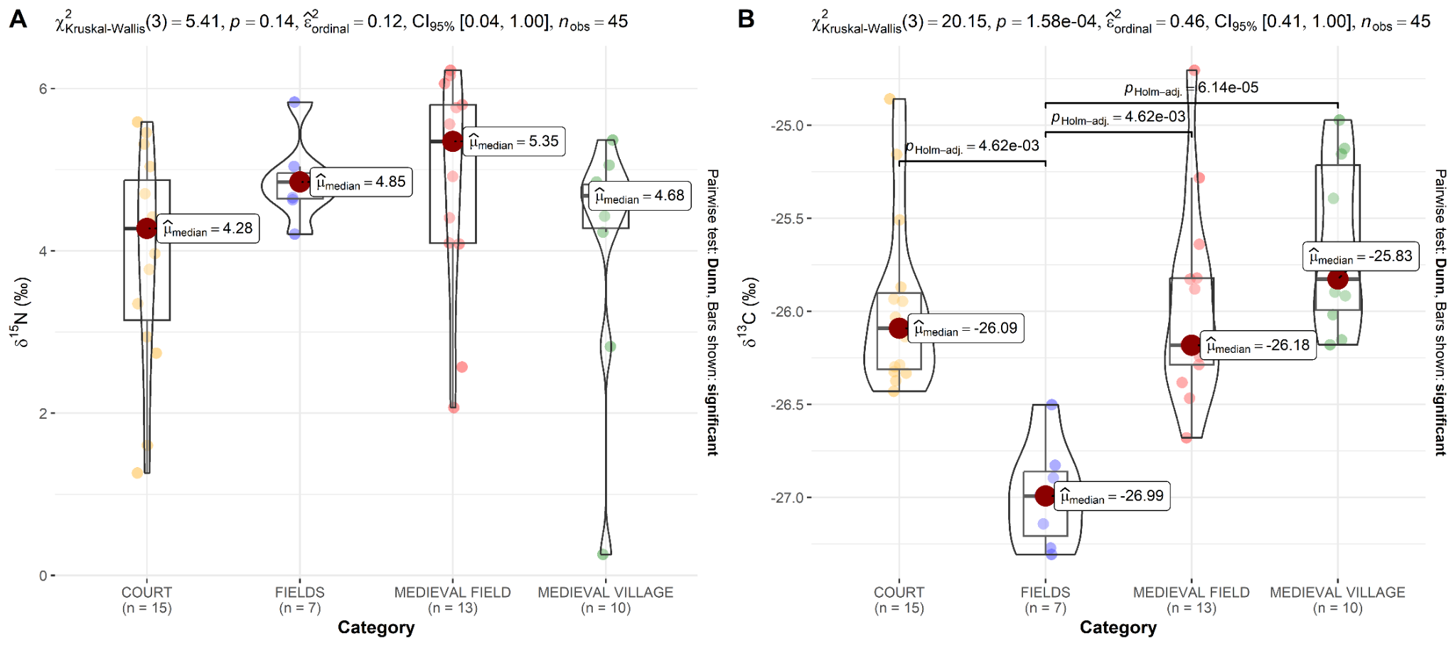
Carbon and nitrogen isotopes help distinguish cultivation, manuring and grazing signals.
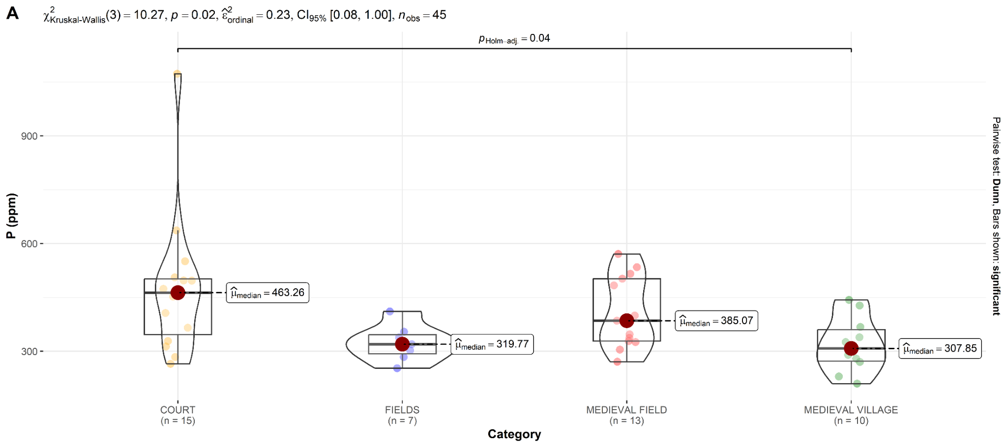
Multivariate analysis reveals spatial variability of soil geochemical signals in the area of a medieval manorial farm
The study combines LiDAR, historical maps, soil sampling, pXRF geochemistry and multivariate analysis to identify activity zones in and around the manor.
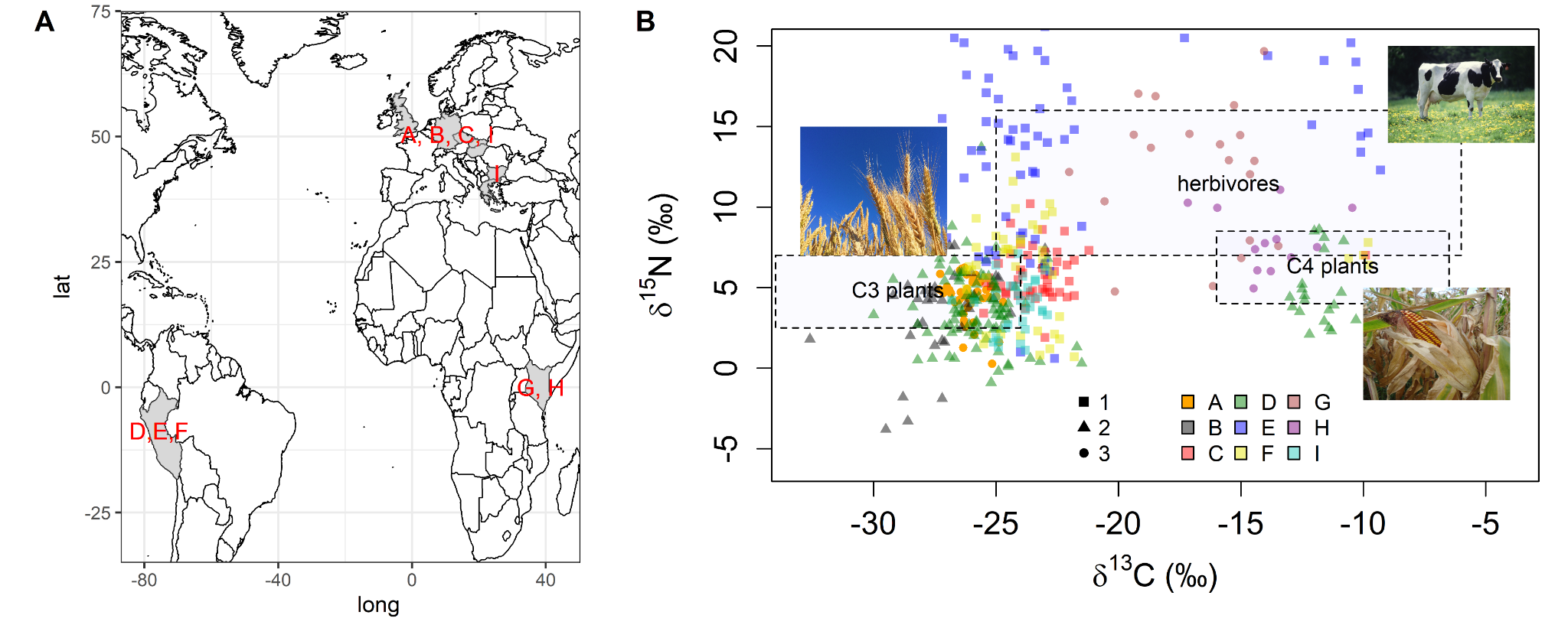
Stable isotope analysis in soil prospection reveals the type of historic land-use under contemporary temperate forests in Europe
The study tests whether carbon and nitrogen isotopes in soil can distinguish former land-use regimes.
Landscape model, LiDAR, geochemistry and stable isotopes.